A curated, tested shortlist of the best QGIS plugins for basemaps, OpenStreetMap queries, classification, profiles, charts and web export — plus how to manage them safely.

Landsat's thermal band lets you map surface temperature across a whole city or landscape. This guide walks through the conversion from raw pixels to a temperature map.
Reference instructions and calculations for GST Calculator — Add or Extract GST & VAT on FreeSky GeoData. Discover essential documentation, standard definitions, and practical examples, real-time calculations, and expert actionable insights for 2026.
Minimizing downside volatility with the BMI Calculator — Body Mass Index & Healthy Weight on FreeSky GeoData. Discover essential protective thresholds, capital preservation, and alert triggers, real-time calculations, and expert actionable insights for 2026.
Next-generation developments in Desi Shop Khata, Profit & School Fee Calculator (PKR) on FreeSky GeoData. Discover essential upcoming standards, machine-assisted workflows, and scalability, real-time calculations, and expert actionable insights for 2026.
Architectural examination of our Freelancer Net Pay Calculator (PKR) — Upwork, Fiverr & Payoneer Fees on FreeSky GeoData. Discover essential data structures, protocol handshakes, and cryptographic safeguards, real-time calculations, and expert actionable insights for 2026.
GIS project inquiries do not wait for business hours. An AI voice receptionist answers your consultancy's line 24/7, captures project leads, and texts back anyone it misses.
GIS prospects do not leave voicemails — they call the next consultancy. An instant missed-call text-back gives every unanswered project inquiry a second chance.
Your best project inquiries arrive after hours. An honest comparison of extended office hours, traditional answering services, and AI — with real costs.
One missed call is not a voicemail — it is a project worth thousands walking to a competitor. The step-by-step math, with every estimate labeled.
Hire office staff, pay an answering service, or use AI? Honest monthly costs, hidden tradeoffs, and where each option actually wins for GIS firms.
Four practical ways to convert KML files to GeoJSON for web mapping — QGIS export, GDAL, Mapshaper, and in-browser JavaScript — plus the pitfalls to avoid.
Shapefiles losing attributes on save in QGIS is almost always a format-limitation problem. Here are the causes — DBF limits, missing sidecar files — and the fixes.
Add OpenStreetMap as a basemap in QGIS using the built-in XYZ tiles, a custom tile connection, or the QuickMapServices plugin — plus CRS and usage-policy notes.
Turn a spreadsheet of coordinates into a real GIS layer: clean the CSV, import it as a delimited text layer in QGIS, and export it as a shapefile.
Get accurate polygon areas in square kilometers with the QGIS field calculator: the right expression, the CRS trap to avoid, and how to save the result permanently.
Build accurate buffer zones around points in QGIS: the CRS prerequisite, the Buffer tool settings, variable distances, and the mistakes to avoid.
Compare the best free Android apps for offline GPS field data collection in 2026 — QField, SW Maps, ODK Collect, Avenza Maps, and offline navigation picks.
Turn an address list into mappable coordinates without paying: free geocoding options, a practical QGIS workflow, and how to keep match quality high.
GIS और मैपिंग पेशेवरों के लिए Muse.ai से जुड़ने, कोड EJHHO6 रिडीम करने और दैनिक कार्यों को तेज़ करने की व्यावहारिक गाइड।
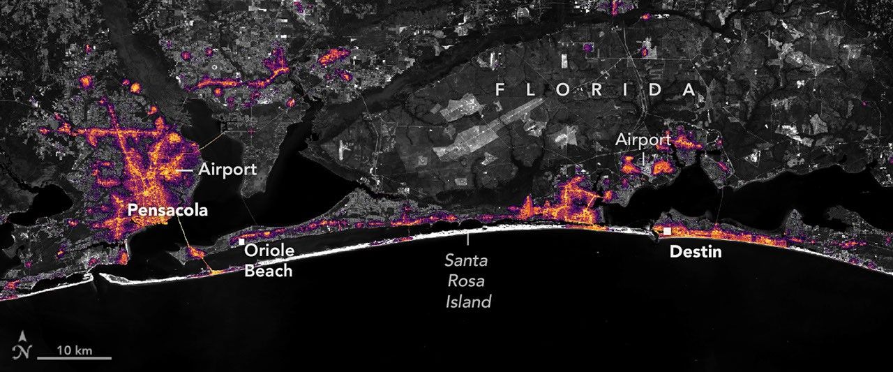
Изображения ночных огней в высоком разрешении показывают, где ураган отключил электричество вдоль Флориды Панхандл и как быстро свет вернулся.
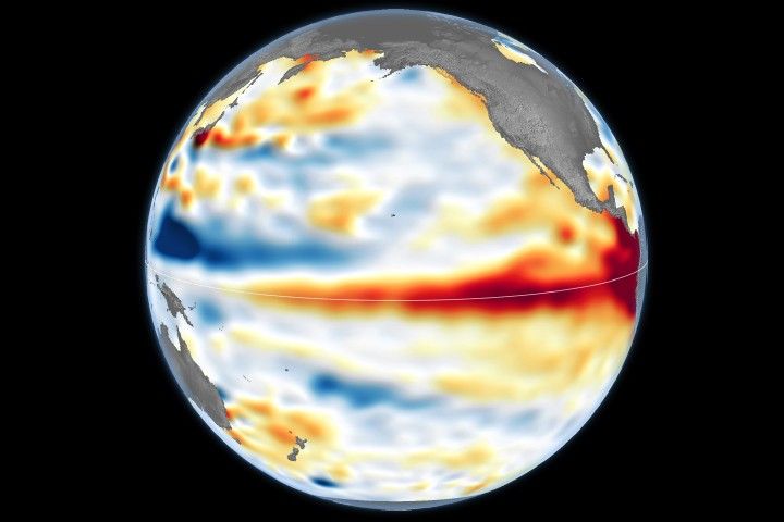
Этой осенью разворачивается явление, более редкое, чем солнечное затмение, и более мощное, чем любая другая штормовая система, и НАСА внимательно отслеживает его. Эль-Ниньо — это естественная климатическая модель, которая возникает примерно каждые два-семь лет и характеризуется более высокой, чем обычно, температурой воды в некоторых частях экваториального пояса.
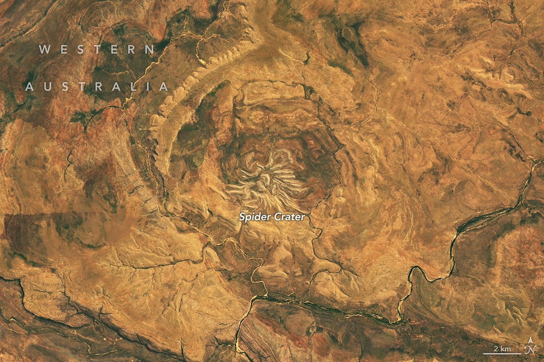
Если мысль о том, что внеземные объекты врезаются в Землю, не была достаточно жуткой, взгляните на кратер Паук в Австралии.
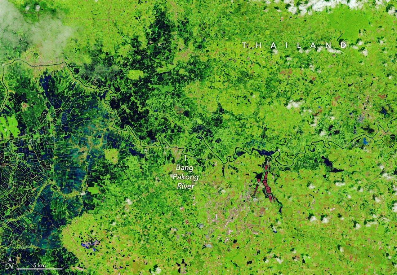
Сильные дожди, начавшиеся с середины сентября, вызвали масштабные наводнения, от которых пострадали миллионы людей по всей стране.